Huge collection of antique prints and maps
Lot 5417:
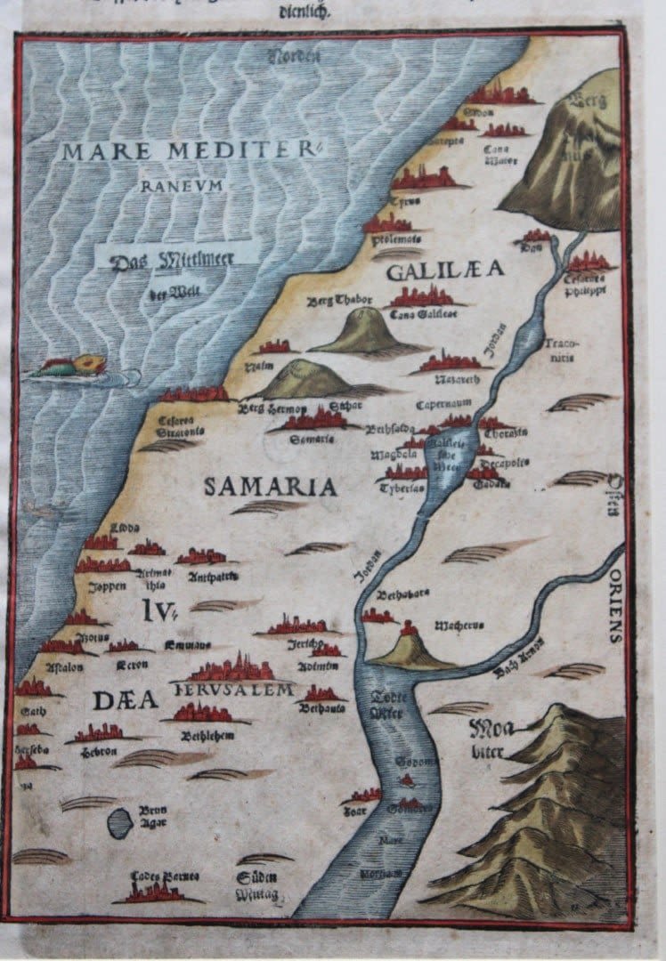
Map of the Holy Land by Heinrich Bunting 1592
Taffel des Heiligen Landes zu dem Newen Testament dienlich, (Tablet of the Holy Land conducive to the New Testament) by Heinrich Bunting, Magdeburg 1582.
North oriented woodcut map of the Holy Land, showing Galilea, Samaria and Judaea areas, from Itinerarium Sacrae Scripturae printed by Jacobus Lucius at Helmstadt, with the German title and hand-coloured.
Nice example of Heinrich Bunting’s map of Palestine and the Holy Land – the map extends from Gaza and Moab in the south to Sidon and Lebanon in the north, tracking the Jordan River in the east. It is believed that more than 60 editions of Bunting’s Itinerarum were published in various languages between 1581 and 1757. Bunting’s work describes the travels of religious figures in the Bible and was the most complete summary of geography of the Bible of this period.
Size: 295 x 195mm
Condition: The print is in excellent condition but please inspect the image carefully as it is very accurate.
Share this lot: